7 Days Classic Kashgar-Tashkurgan-Urumuqi-Turpan Group Tour
We must thank God for collecting most valued attractions into three cities of Xinjiang, Urumqi, Turpan and Kashgar. Within the golden triangle district, you can explore as many spots as you list though Xinjiang is actually immense. If it's your first time to Xinjiang, this route won't disappoint you for sure!

Duration
7 Days
Group Size
16
Max Altitude
3100
Best Time
Apr. to Oct.
Itinerary
Welcome to Kashgar, the westernmost frontier city in China, known as a dazzling jewel on the ancient Silk Road. Upon your arrival at Kashgar airport, your driver will greet you at the exit. They'll then escort you directly to the downtown area and assist you with checking in at your hotel.
Kashgar, located in the southwestern part of Xinjiang, was historically known as Shule, and was one of the thirty-six kingdoms of the Western Regions. For centuries, Kashgar has been a significant city in southern Xinjiang. It served as the western terminus for the northern, central, and southern routes of the ancient Silk Road, connecting Europe and Asia. It has long been a transportation hub and distribution center for goods between East and West. Trade is highly developed here, earning it the title of "Kingdom of Bazaars (markets)."
Diverse cultures from Asia and Europe converge on Kashgar, clashing and blending intensely with the local culture, injecting new vitality into Kashgar. This cultural fusion is specifically reflected in Kashgar Old City's architecture, cuisine, and vibrant markets. The city has always been a melting pot of various ethnic groups, including Uyghurs, Han Chinese, Tajiks, and other nationalities. Additionally, located at the junction of the Pamir Plateau and the Tarim Basin, Kashgar also serves as a gateway to some stunning natural landscapes.
Note: We recommend choosing a morning flight to Kashgar, as you'll need to apply for a border permit in advance (office hours: 10:30 AM–6:00 PM). This permit is required for entering border areas such as Tashkurgan County and the Pamir Plateau on the second day.
Arrival Ideas: By Air: Kashgar International Airport (IATA: KHG, ICAO: ZWSH) is one of China's westernmost airports. Domestic flights connect Kashgar to major Chinese cities, including:Urumqi (about 2 hours), Lanzhou (about 4 hours), Beijing (about 6 hours), Shanghai (about 7 hours), Xi'an (about 5 hours), Chengdu (about 5 hours), and Guangzhou (about 7 hours). Some international flights from nearby Central Asian countries may also fly into Kashgar.
From Borders:The Torugart Pass and Irkeshtam Pass are important channels between China and Kyrgyzstan. The Karasu Port is a crucial gateway between China and Tajikistan. The Khunjerab Pass is the only land border crossing between China and Pakistan. If you plan to arrive via a land border, please contact your travel advisor for specific costs and arrangements.
Meal: /
Accommodation: Kashgar
This morning, your guide and driver will pick you up from your hotel in Kashgar to embark on an exhilarating road trip along the China-Pakistan Highway. Along the way, you can enjoy the beautiful landscape of Pamirs Plateau, visit Baisha Lake and Karakul Lake, admire the distant and mysterious Muztagh Ata Peak, Kongur Tagh, Kongur Tiube, and conclude in Tashkurgan. (Total distance: 300 kilometers, approximately 7-8 hours of travel)
The China-Pakistan Highway, also known as the Karakoram Highway (KKH), is one of the world's highest paved international roads. It connects China and Pakistan across the Pamir Plateau and is locally referred to as the Pamir Highway. Historically, routes across the Pamir Plateau - known as Congling in ancient times - were vital parts of the Silk Road. This section posed one of the most daunting challenges for merchants and travelers due to its harsh, rugged terrain. Here, several of the world's renowned mountain ranges - the Himalayas, the Karakoram, the Kunlun Mountains, the Tianshan Mountains, and the Hindu Kush - converge and radiate outward, forming a massive mountainous junction. Today, the China-Pakistan Highway has transformed these perilous trade routes of the past into magnificent thoroughfares, attracting numerous tourists to the Pamir Plateau to experience its stunning natural scenery.Along the way, you will visit the following attractions:
Baisha Mountain-Baisha Lake Scenic Area: As you drive along National Highway G314, you'll encounter Baisha Lake, also known as Bulunkou Lake - a striking plateau lake nestled in the Pamir Plateau (elevation: about 3,660 meters). From its shore, you're treated to a stunning vista: half pristine blue water, and half white sand mountain, both harmonizing with distant snow-capped peaks to create a magnificent spectacle.On the lake's northern shore stands the renowned Baisha Mountain, winding for over 1,200 meters. The dark mountain body, covered with white sand, presents a soft silvery-white color under the clean sunlight of the Pamir Plateau, resembling white silk. Legend has it that as the lake water gradually dries up in autumn and winter, the white sand at the bottom of the lake emerges. In spring, the wind blows this sand onto the mountain, creating the extraordinary spectacle of sand accumulating into a mountain. Whenever strong winds blow, Baisha Mountain emits a sound, earning it the name "Singing Sand Mountain." The southern shore of the lake is embraced by a chain of snow-capped mountains, with the highest peak being Mount Kongur Tagh at an elevation of 7,530 meters, adding further grandeur and mystery to this captivating landscape.
Karakul Lake: Karakul Lake is a high-altitude moraine lake (elevation: about 3,600 meters).Its name in the Kyrgyz language means "Black Lake," attributed to its deep, dark waters. However, if you spend enough time by the lake, you will notice that it changes colors under different lighting conditions, appearing deep blue, emerald green, or ink black, earning it the nickname "the ever-changing lake."Yet, the true highlights of Karakul Lake are the imposing peaks known as the "Kunlun Trio" that tower behind it: Kongur Tagh, Kongur Tiube, and Muztagh Ata, with altitudes of 7,719 meters, 7,595 meters, and 7,546 meters, respectively. On clear days, their majestic reflections are perfectly cast upon the glistening surface of the lake, creating the most iconic views of Karakul Lake. Among these, Muztagh Ata is particularly striking, covered with many glaciers, and is known as the "Father of Ice Mountains."
Afterward, drive to Tashkurgan County for accommodation.
Meal: Breakfast
Accommodation: Tashukurgan


Today, you will be exploring Tashkurgan County before driving back to Kashgar along the scenic China-Pakistan Highway.
Tashkurgan or Taxkorgan, officially known as Tashkurgan Tajik Autonomous County, is situated in the eastern part of the Pamir Plateau, at an elevation of about 3,600 meters. In Uyghur, Tashkurgan means "Stone Fort," a name derived from the ancient stone fortresses located to the north of the town. It has the unique geographical advantage of being "one county bordering three countries," namely Tajikistan, Afghanistan, and Pakistan. As the final pass of the Silk Road within China's borders, Tashkurgan has been both an outlet for Central Plains civilization and a gateway for religious transmission throughout history.
After breakfast, you will set out to explore Stone City, also known as Tashkurgan Fort, a fortress of great strategic importance on the ancient Silk Road. Archaeological evidence During the Han period, it was once the capital of the Puli Kingdom one of the thirty-six states of the Western Regions. After the Tang Dynasty unified the Western Regions, it became the largest post station on the ancient Silk Road crossing the Congling (Pamir Plateau). The renowned Chinese Buddhist monk Xuanzang stopped here to preach for 22 days on his return journey from India.
It is built on a high hill, with an extremely steep terrain, mainly constructed from piled stones, forming a unique stone city landscape. For travelers, it is a fantastic experience to explore the city ruins, witness the vicissitudes of the ancient city, and imagine how many merchants, monks, and explorers once traveled westward or eastward from here, or ponder how the Tajik ancestors, over a thousand years ago without advanced tools, managed to complete such a massive and magnificent project.
Following your visit to the fort, you will explore the expansive Golden Grasslands at the foot of the Stone City. This area, known as Alar National Wetland Park, comprises wetlands, meadows, rivers, marshes, snow-capped mountains, and plateaus. The Tashkurgan River flows through this area, where lush water and grass abound, and livestock roam freely, blending beautifully with the distant snow-capped mountains, white clouds, and blue sky. When the setting sun casts its light, the verdant grasslands turn a golden hue, and in the distance, the herders' white felt tents and flocks of sheep are bathed in the sunset as if cloaked in a golden glow. Hence, this area is aptly named "Golden Grasslands."
Lastly, you will leave Tashkurgan and drive back to Kashgar city along the scenic China-Pakistan Highway. This journey is not merely a return trip but a continuous discovery of the profound and majestic beauty that defines the Pamir Plateau. You'll have the opportunity to admire the spectacular snow-capped peaks from various angles on both sides. Muztagh Ata, Kongur Tagh, and Kongur Jiubie Peak form a triangular configuration, standing like towering pillars on the Pamir Plateau. Stay overnight in in Kashgar city.
Meal: Breakfast
Accommodation: Kashgar


Your exploration can begin in Kashgar Old City. The Old City is the soul of Kashgar, encapsulating over two millennia of cultural and commercial exchanges along the Silk Road. Situated at the heart of the city and spread across 3.6 square kilometers, the Old City is a living museum, telling tales of ancient trade and cultural fusion. As a crucial hub for East-West traffic and a distribution center for goods, it offers a vivid glimpse into past prosperity.
Within Kashgar Old City, the streets and alleys intersect intricately, narrow and winding paths with buildings of varying heights, creating a layout that resembles a maze. As you wander through, you'll see traditional Uyghur mud-brick houses and numerous structures with Islamic features, such as pointed arches, domes, intricate woodcarvings, and colorful ceramic tiles. These architectural and street designs perfectly Central Asian and Islamic architectural elements with Uyghur characteristics, creating a sense of time travel for visitors.
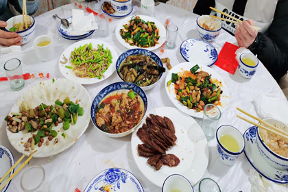
The Kashgar Old City thrives with commercial activity, with numerous bazaars and street markets scattered throughout, such as the Pottery Bazaar, Flower Pot (Doppa) Bazaar, Blacksmith Bazaar, Woodwork Bazaar, Medicine Tea Bazaar, Han Bazaar (Food Street)... This area is not only an excellent place to purchase and appreciate various handicrafts but also an ideal spot to savor Uyghur cuisine. Indulge in succulent lamb kebabs, rich and spicy lagman noodles, savory samsas, and freshly baked Naan. As you wander through, the scenes, sounds, and scents on the streets seem to transport you back to the heyday of the Silk Road. You can almost visualize the bustling caravans, with merchants from China, Persia, Arabia, and many local regions converging here. The air is filled with the melodious ringing of bells on camels' necks.
Furthermore, Kashgar Old City is a hub for numerous cultural and religious activities as well as a place for residents' daily lives and social interactions. One of the most notable landmarks is Id Kah Mosque, one of the largest mosques in China, attracting thousands of worshippers daily.
After the tour, you'll be escorted to the airport for your flight to Urumqi. Upon arrival at Urumqi airport, your will be transferred to the hotel in downtown Urumqi.
Meal: Breakfast
Accommodation: Urumuqi


Today, you'll embark on a full-day exploration, from the breathtaking natural beauty of Tianshan Tianchi Lake to the hustle and bustle Xinjiang International Grand Bazzar.
In the morning, you'll be driven approximately 70 kilometers (about 1-1.5 hours) to Heavenly Lake of Tianshan, a UNESCO World Heritage Site. Nestled at an elevation of around 1,980 meters (6,500 feet) above sea level, this serene alpine lake is surrounded by lush forests, snow-capped peaks, and breathtaking landscapes. Renowned for its crystal-clear waters, panoramic Bogda mountain views, and connections to ancient myths and legends, Heavenly Lake is a must-see. One such legend involves the Queen Mother of the West (Xi Wangmu), who is said to have hosted a banquet for the Eight Immortals here.
Upon arrival, you'll first take 40-minute sightseeing bus ride through the dramatic mountains. Then, enjoy 10-minute walk to the picturesque lake. Enjoy a leisurely stroll around Heavenly Lake, taking in the fresh mountain air and diverse flora and fauna.
Optional Activities (additional fee required):
1) Boat Ride: Cruise across the peaceful waters of the lake, immersing yourself in its beauty and the reflections of the snow-capped mountains.
2) Cableway Ride: Take a cableway up to Mayashan for even more stunning views of Bogda Mountain.
After lunch, return to Urumqi and visit the Urumqi International Grand Bazaar. It is a vibrant marketplace and a perfect way to spend your free time. Explore the many shops and stalls offering various local products, including traditional Uyghur clothing, carpets, handmade crafts, silk scarves, jewelry, spices, and dried fruits. Be sure to try local favorites such as lamb kebabs, polu (pilaf), naan bread, and laghman (hand-pulled noodles). Additionally, the architecture of the Grand Bazaar itself is worth admiring with its grand minarets, domes, and intricate Islamic-inspired designs.
After the tour, be escorted back to your hotel in Urumqi.
Meal: Breakfast
Accommodation: Urumuqi


After breakfast, embark on a scenic 3-hour drive (180 km) from Urumqi to Turpan. Along the way, you’ll pass the striking Salt Lake and the impressive wind power station, the largest in Asia, at the foot of the Tianshan Mountains.
Turpan is located in the eastern part of Xinjiang. Situated in the Turpan Depression at 154 m below sea level, it's the second-lowest depression in the world and the hottest spot in China, earning it the nickname "Fire Land."
Despite its arid climate, the ingenious Karez irrigation system has transformed this desert region into a fertile oasis, renowned for its agriculture, especially grape production. As a crucial stop on the ancient Silk Road, Turpan served as a hub for trade and cultural exchange between East and West. The area is dotted with historical sites - ancient city ruins, remnants of fortifications, and Buddhist cave complexes - testifying to its rich cultural roots.
Upon arrival in Turpan, you will drive to Tuyoq Valley along the Flaming Mountain Grand Canyon. The Flaming Mountains (Huoyan Shan), named for their intense heat and reddish-brown sandstone that appears to glow like fire under the desert sun, are one of Turpan’s most iconic landscapes. Stretching over 100 kilometers from east to west, these eroded hills create a striking, otherworldly view. Along the way, we can stop for photos.
The winding road along the cliffs of the Flaming Mountains will soon lead you to Mazar Village, nestled in the Tuyoq Valley. It is the oldest surviving Uyghur village, with a history of over 1700 years. The mud-constructed town offers a glimpse of traditional Uighur life and architecture. Here, every household grows mulberry, apricot, or jujube trees around their homes. The doors are adorned with colorful paintings of flowers and fruits, and the window lattices are also decorated with a variety of motifs. The ancestors of Mazar Village, adapting to the local environment and survival needs, ingeniously used locally sourced yellow clay to construct their homes. This has resulted in one of the best-preserved earthen architecture complexes in China today. The earth-toned dwellings adorned with colorful door frames, set against the backdrop of red mountains, are extremely photogenic.
Next, visit to Jiaohe Ancient City, one of the best-preserved ruins of ancient cities along the Silk Road and inscribed on the UNESCO World Heritage List as part of the joint application "Silk Roads: the Routes Network of Chang'an-Tianshan Corridor." Jiaohe Ruins offers a profound glimpse into ancient city planning and the historical complexity of the civilizations on the Silk Road.
Nestled between two deep river valleys, Jiaohe, meaning "the confluence of two rivers," is strategically positioned on a large, steep plateau that provides formidable natural defenses. As a key city connecting the Central Plains and the vast regions of the Western Regions, Jiaohe Ancient City played a vital role in the transportation network of the Silk Road. It witnessed the bustling trade along the Silk Road and the exchange and integration of Eastern and Western cultures.
Unlike many ancient cities, its structures were not built up from the ground but carved down into the existing plateau of loess soil. Walking through the ruins, you can see the remains of government offices, residential houses, Buddhist stupas, and temples. These remnants not only provide important physical evidence for studying the history and culture of the Silk Road but also offer valuable insights into the social, economic, and religious life that shaped this region. Tips: There is no shelter inside the ruin, so be mindful of sun protection.
The History of Jiaohe Ancient City:
The Ancient City of Jiaohe witnessed the development of civilization in the Western Region and the Silk Road. Approximately 2,000 years ago, it was established as the capital of the Jushi Kingdom, one of the 36 kingdoms in the Western Regions. Following Zhang Qian's pioneering efforts during the Western Han Dynasty to carve a path through the Western Regions, Jiaohe City emerged as a crucial hub on the Silk Road. In 60 BC, the Han Dynasty central government established the Protectorate of the Western Regions to administer the various states in the region, officially incorporating the Western Regions into the Chinese domain. During the Northern and Southern Dynasties, Jiaohe became a county under the jurisdiction of Gaochang. The city reached its zenith during the Tang Dynasty with the establishment of the Anxi Protectorate, marking a new era in the governance of the Western Regions. During this period, Jiaohe was a bustling center of international trade and vibrant cultural exchanges among diverse ethnic groups. From the 19th to the 14th century, due to the impact of wars, Jiaohe gradually declined and eventually became a ruin.
Afterwards, head to the Karez System to learn about the ancient underground irrigation system a few thousand years ago and how this system has benefitted the people along the desert's edge, transforming barren land into a lush oasis. This traditional engineering marvel is considered one of China’s three great ancient engineering projects, alongside the Great Wall and the Grand Canal. It has been recognized in the 2024 World Irrigation Project Heritage list.
The origin of the Karez Irrigation System:
Turpan, in Xinjiang, is one of China's most arid regions, with annual rainfall of only 16 millimeters and evaporation exceeding 3,000 millimeters. These extreme conditions have led to severe surface water scarcity. To improve their survival prospects, people ingeniously utilized the natural slope of mountains to channel underground rainwater, glacial melt, and snowmelt from spring and summer to the surface for irrigation. This method greatly reduced water loss through surface evaporation, meeting the water needs of this arid region. It’s often said, "Without the Karez, there would be no Turpan; without the Karez, there would be no civilization in Turpan." The Karez has turned extremely arid basins into green havens, making Turpan a crucial corridor for East-West exchanges along the Silk Road and a place where diverse cultures converge and coexist.The Karez system is often referred to as the "Underground Great Wall". In Xinjiang, there are over 1,700 karez wells which, if connected, would stretch over 5,000 kilometers, forming a vast underground river network. It is estimated that the Karez system has a history of over 2,000 years. Imagine centuries ago, without modern measuring tools or mechanical assistance, how ancient people located underground water sources, determined the gradient and direction in complete darkness, and connected such lengthy channels. Today, you have the opportunity to step into the Karez and personally unravel the secrets of this most mysterious hydraulic engineering project, experiencing first-hand how ancient innovation works.
Next, continue your exploration at the Emin Minaret, the tallest Islamic minaret in Xinjiang. Also known as Sugong Ta, this remarkable structure was erected in 1778 by the local ruler Suleiman, in tribute to his father, Emin Khoja, whose considerable efforts helped maintain national unity.
It stands 44 meters (144 feet) tall and is made from sun-dried bricks, which give it a distinct, earthy color. The tower's cylindrical body tapers elegantly as it rises, topped by an ornate, pointed dome. Uyghur artisans crafted up to 15 different types of brick patterns, including waves, diamonds, floral clusters, and crosses, which create endlessly looping designs around the tower. Gazing up from beneath the tower, you can fully appreciate the simplicity and grandeur of these designs. The accompanying mosque is an integral part of the complex, which you can visit as well. Emin Minaret serves not only as a religious structure but also as a cultural icon for the Uyghur people, embodying a unique blend of Islamic and Uyghur architectural traditions.
After the tour, be escorted to your hotel in Turpan.
Meal: Breakfast
Accommodation: Turpan


On this day, you'll be transferred from Turpan to Urumqi airport for your flight departure (about 3-hour drive).
Meal: Breakfast
Accommodation: /
Service Inclusions
- Local transfer (Tourist vehicle type depending on the group size): Flight from Kashgar to Urumuqi (economic class)
- Standard accommodation: 3-star standard hotel, twin share basis, with daily breakfast
- Experienced bilingual Chinese & English speaking guide: This trip opens booking for both Chinese citizens (including Hong Kong, Macau and Taiwan travelers) and foreign travelers. English speaking guide will be arranged.
- Entrance tickets: Baisha Lake, Karakul Lake, Stone City (Including scenic site bus), Id Kah Mosque, Heavenly Lake (including scenic site bus), Emin Minaret, Jiaohe Ruins, Tuyoq Village, Karez Well
- Pick-up on Day 1: Airport: 09:00am-22:00am; Train station: anytime based on your schedule. You may need to wait for 1.5~2hrs for other travelers who arrive at similar time
- Government tax
- Service fee
- Tourist insurance
- 2 bottles of water per day
Service Exclusions
- Transport to Kashgar and leave Urumuqi
- Meals not mentioned
- Tips to the guide and driver: We suggest to offer 20~50 RMB per person oer day to driver and 40~70 RMB per person per day to guide. But you can tip based on their performance.
- Single room supplement
- Optional program and personal expenses
- Extra cost caused by force majeure
Value Added
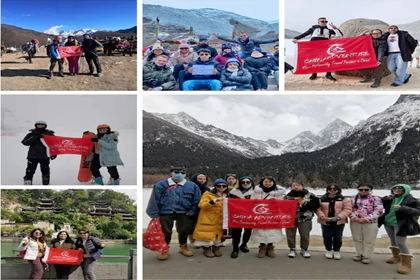
1. 7*24 English Professional Customer service Support! Whenever you are in need, our customer service will be available to help you.

2. Easy booking and Flexible cancellation! Unlike most travel agency, we do provide free cancellation policies to travelers with good reason such as disease, covid, family emergency etc.
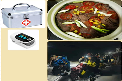
3. Safety guarantee journey and well-equipped logistic support team
For mountain hike trip , we provide
Professional Climbing Equipment and Well-prepared Logistic Support

4. We took to you less-tourists visited off the beaten path only to let you know real China
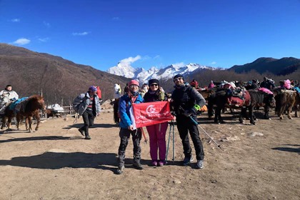
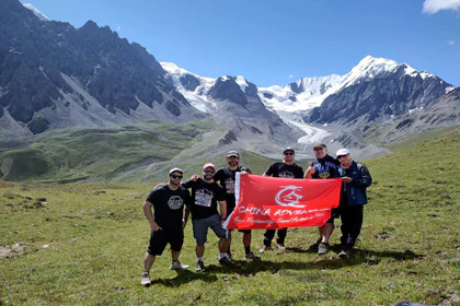
5. Special gifts , free holiday dinner and souvenirs for holidays from China Adventure Team
Reviews
No reviews for this product yet.